 Oculus, Amazon, Uber, and Google are the household names most associated with innovations in autonomous vehicles, virtual reality, and drones. John Deere? Not so much. But the agricultural industry has a long track record of acting as a testing ground for new technologies well before they’re a blip on consumers’ radar. The agricultural industry has always been an early adopter of technology. Prehistoric farmers practiced selective breeding to create the optimal traits in plants, otherwise known as genetic modification. In the early 1800s, Eli Whitney introduced a rifle made with interchangeable parts. Shortly after, farmers began adopting iron plows with interchangeable parts. While we might not immediately think of farmers as innovators, they’ve been ahead of the curve for centuries.
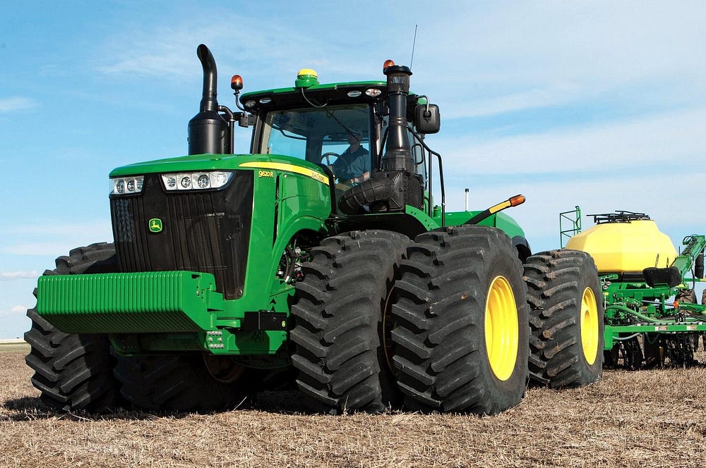
While Google’s autonomous cars are still being tested, John Deere has been sending GPS-controlled tractors into the fields since 2002. These tractors can efficiently plant, harvest, and fertilize fields without the farmer needing to turn the steering wheel. Since 1992, farmers have been using GPS images with a resolution of several feet to make choices about drainage, seeding, and more. John Deere saw the opportunity to commercialize GPS technology and autonomous control of tractors for its customers and, in 1994, established the Precision Farming Group to position itself at the forefront of the farming industry.
Emerging from all this came AutoTrac, John Deere’s autonomous tractor technology. Tractors today can fully guide and steer themselves through fields and perform a variety of tasks with no steering required from the driver. These systems are accurate to a few centimeters, eliminating wasted passes across the field, which saves farmers’ time and fuel. Multiple machines can even work together simultaneously, syncing their routes and operating in close proximity. Keep in mind that tractors can be extremely large machines that can weigh more than 40,000 pounds, not including the attachments. Keeping these vehicles on track is a tough engineering challenge and is crucial to ensuring the safety of everyone working around them. Touchscreen inputs, air conditioning, and GPS controls make these machines look more like vehicles of the future and less like harvesters of the past.
As a result of this technology’s ease of use and clear benefits, its utilization has grown immensely. According to John Deere, between 60 and 70 percent of the crop acreage in North America today is farmed using AutoTrac or similar systems. Internationally, these numbers reach even higher — in Australia, for example, the number exceeds 90 percent.
With all the new features being developed for its tractors, John Deere has integrated virtual reality into its product design process to test new functions before they are produced. By creating a single makeshift tractor seat and controls, engineers can get design feedback by putting customers into a virtual world. Users see the tractor and the new features in front of them and how they operate. This allows designers and engineers to make changes based on input from the people who will be using these products every day.
To truly get the most out of the fields, companies like Altavian, Agribotix and PrecisionHawk are working on improving agricultural technology in areas other than directly interacting with plants, such as collecting data about crops and fields. Engineers are exploring how best to input this information into the tractors’ automatic guidance systems and create improved connections between collected data and a farmer’s daily tasks. The goal is to get current information about their fields, and then adapt field treatment based on that information. For example, if a farmer finds out that the left half of a field is less healthy than the right, the farmer might then apply fertilizer only to the left half, saving money and resources by not using excess fertilizer and, ideally, resulting in a better crop yield.
The drone industry is a primary sector working on pushing agriculture forward in this area. Although aerial imaging has been around since the 1940s, improvements in image resolution in recent years have led to more data acquisition opportunities. Drone images now can clearly show fields down to the centimeter, allowing farmers to analyze the health of individual plants instead of performing an annual whole-field aerial analysis.
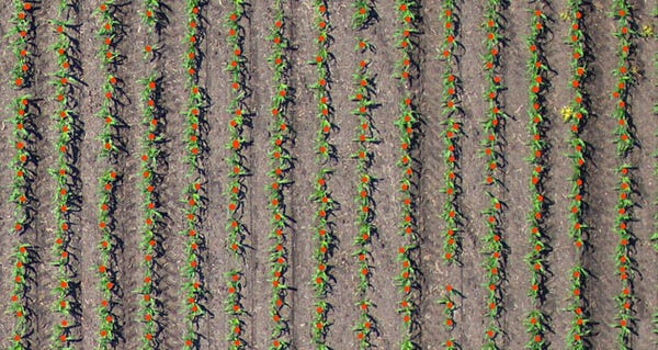 Drone image being used for stand-count calculation. Credit: Altavian
That combination of drones and agriculture occurred for a few reasons, but one of the main catalysts was regulation. The Federal Aviation Administration (FAA) put strict regulations on drones in the 2000s but in 2015, it began to allow exceptionslargely based on risks posed in certain air spaces. The FAA restricted flight near other people, near airports, and within a mile line-of-sight.
“When you put all of those together, it puts you in the middle of nowhere,” said Thomas Rambo, COO and co-founder of drone manufacturer Altavian. “What happens to be in the middle of nowhere? Farms. Drones started to get out there. Farmers started to use them.”
There’s a gap, however, between what you can do with a drone and what you can do with this data to create money-saving opportunities and ease the workload on farmers.
“Plugging in drone-acquired aerial data to the rest of the workflow is where the industry sits right now,” Rambo said. “The goal of this would be you fly a drone, you process the data, and you create a prescription for your field based on that. From the technology point of view, it’s totally doable. From an economics perspective, there is an adoption curve we are experiencing.”
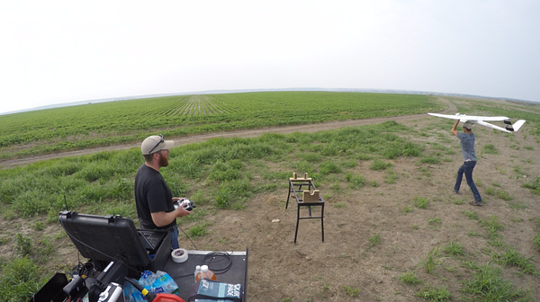
Flying an Altavian Nova drone in high winds. Credit: Altavian
The agriculture industry is at the tipping point of bringing more drones to the fields. Wide-open lands and the need for aerial data has made agriculture the perfect testing ground for automated drones and their use in new industries. As soon as all the dots can be connected, farmers will have the ability to bring automation to the next level. Since drones, data processing, data analysis, and tractors are all automated, the only primary human interaction is the movement of the information between these steps. According to Rambo, a common misconception about drones in agriculture is that the drone can stream real-time data back to your computer or other device. Because of the large quantity of data produced, however, this is not currently possible. Altavian collects up to 10 gigabytes of data in an hour, so it’s all stored onboard. Once the drone lands, the data is ready to go when you pull it off the drone.
Although drones are not yet flying over every field, Altavian has seen much greater awareness among farmers of the compatibility between drones and farming at industry trade shows.
“Sometime in the last two years, we have gone from growers not knowing a whole lot about drones to virtually everybody who came by knowing drones can be useful in agriculture,” Rambo said. “The concept has been adopted that drone technology can be used in agriculture.”
Once the steps between data and tractor are minimized, the devices can communicate with each other, and the economics of drone data are confirmed, the agricultural industry will be ready to move even further forward in its technological innovations. This will keep farming on the forefront of finding practical applications for our latest technologies.
No comments:
Post a Comment